


AI for Social Good
Open-source tools, demos, and software built by our scientists and engineers — free to explore and use.
DisasterVQA
Social media imagery offers a low-latency source of situational information during natural and human-induced disasters, but the complex, safety-critical reasoning required for disaster response is poorly served by general-purpose vision–language models. We introduce DisasterVQA, a benchmark dataset designed for perception and reasoning in crisis contexts. It comprises 1,395 real-world images and 4,405 expert-curated question–answer pairs spanning diverse events such as floods, wildfires, and earthquakes. Grounded in established humanitarian frameworks including FEMA’s Emergency Support Functions (ESF) and OCHA’s Multi-Cluster/Sector Initial Rapid Assessment (MIRA), the dataset features binary, multiple-choice, and open-ended questions that target both situational awareness and operational decision-making. DisasterVQA provides a challenging and practical benchmark to guide the development of more robust and operationally meaningful vision–language models for disaster response.
DSGR
We introduce Domain Shift across Geographic Regions (DSGR), a new large-scale dataset designed to study the effects of real-world geospatial distribution shifts in satellite imagery classification. DSGR captures variability across diverse geographic regions, with particular emphasis on underrepresented areas such as Africa and Oceania, enabling systematic analysis of how regional differences impact model performance. This dataset is motivated by a fundamental limitation of deep learning models: they are typically trained under the i.i.d. assumption and often suffer significant performance degradation when deployed in environments that differ from the training data. Domain Generalisation (DG) aims to address this challenge by improving model robustness to Out-Of-Distribution data without access to target domains during training. By explicitly modelling geographic domain shifts, DSGR provides a valuable benchmark for advancing DG research in satellite imagery classification.
AIDR – Artificial Intelligence for Digital Response
AIDR—the Grand Prize winner of the 2015 Open Source Software System Challenge—is a free and open platform to filter and classify social media messages related to emergencies, disasters, and humanitarian crises. AIDR uses human and machine intelligence to automatically tag up to thousands of messages per minute. https://aidr.qcri.org

Cipherbot: AI-Powered Transformation of Learning
Cipherbot is an AI teaching and learning platform that turns existing course and curriculum materials into AI-generated lesson plans, slides, narrated videos, study guides, and assessments, while giving learners a 24/7 multilingual tutor that answers only from the instructor’s content, with citations back to the source. Built for the full education spectrum—from national ministry deployments to K-12 schools, universities, and corporate training partners—it combines configurable AI pedagogy, early at-risk-student analytics, automated grading, and full LMS integration. Pilot-tested and adopted by institutions across multiple countries—including Qatar, Korea, Australia, Finland, China, Vietnam, and Indonesia—Cipherbot has served over 4,200 active users, including 400+ teachers and 3,000+ students across 800+ classes, all as part of a social-impact initiative bringing safe, citation-backed AI into everyday teaching and learning.
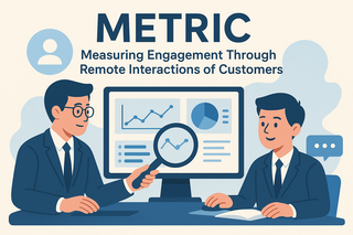
METRIC: Measuring Engagement Through Remote Interactions of Customers
METRIC is a tool for collecting, measuring, analyzing, and reporting the engagement of online systems through real interactions of customers or users, including real-time. METRIC enables system stakeholders to enhance understanding of their customers via actual behavior on particular pages in the online systems, including the focus and interaction with sub-elements on a page within that system.

Survey2Persona
Survey2Persona is a survey data analysis and visualization tool. It transforms numerical survey responses (e.g., Likert scale, Binary, or other categorical data) and associate demographic survey data into personas, a humanized representation of the underlying survey data presented as a believable person, containing picture, name, age, country, and other demographic attributes and information.
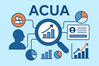
Acua
Acua is the organizing theme of our research efforts, focusing on audience, customer, and user analytics for an enhanced understanding of these populations for an organization. Our efforts concentrate on research for collecting, measuring, analyzing, and reporting digital data to enhance insights into the behavior of audiences, customers, and users, with the development of systems to support these activities central to the research.
RWDS
Object detectors achieve strong performance on benchmark datasets, yet most are trained under the i.i.d. assumption, leading to significant degradation when deployed under real-world distribution shifts. Domain Generalisation (DG) addresses this challenge by enabling models to generalise to unseen, Out-Of-Distribution data without access to target domains during training. However, evaluating object detection under realistic DG conditions remains difficult due to the lack of standardised benchmarks. To fill this gap, we introduce Real-World Distribution Shifts (RWDS), a suite of three benchmark datasets designed to assess the robustness of state-of-the-art object detectors under realistic spatial domain shifts. Grounded in humanitarian and climate change applications, RWDS enables systematic evaluation across diverse climate zones, disaster types, and geographic regions, providing a timely benchmark for developing object detectors that generalise beyond the training setup.
Incidents1M
Natural disasters, such as floods, tornadoes, or wildfires, are increasingly pervasive as the Earth undergoes global warming. It is difficult to predict when and where an incident will occur, so timely emergency response is critical to saving the lives of those endangered by destructive events. Fortunately, technology can play a role in these situations. Social media posts can be used as a low-latency data source to understand the progression and aftermath of a disaster, yet parsing this data is tedious without automated methods. Prior work has mostly focused on text-based filtering, yet image and video-based filtering remains largely unexplored. In this work, we present the Incidents1M Dataset, a large-scale multi-label dataset which contains 977,088 images, with 43 incident and 49 place categories. We provide details of the dataset construction, statistics and potential biases; introduce and train a model for incident detection; and perform image-filtering experiments on millions of images on Flickr and Twitter. We also present some applications on incident analysis to encourage and enable future work in computer vision for humanitarian aid.
Global Landslide Detector
The development of a system that monitors social media continuously for general landslide-related content using a landslide classification model to identify and retain the most relevant information is described and validated. The system harvests photographs in real-time from these data and tags each image as landslide or not-landslide. A training model was developed with input from computer scientists, geologists (landslide specialists) and social media specialists to establish a large image dataset that has then been applied to the live Twitter data stream. The preliminary model was developed by training a convolutional neural network on the dataset. Quantitative verification of the system’s performance during a real-world deployment shows that the system can detect landslide reports with Precision = 76%.
Flood Insights
The Flood Insights Dashboard (FID) is a comprehensive tool for evaluating the immediate flood situation during the onset of a flood disaster. Using the best available data, methods and analytical tools, FID synthesizes satellite, social media and geospatial data to help guide crisis responders in making effective decisions.
Mapping Education Insecurity
This visual shows reports of attacks on education in Africa and the Middle East from the Armed Conflict Location & Event Data Project (ACLED) as well as social media posts from Twitter about education insecurity identified by the Artificial Intelligence for Digital Response (AIDR) platform. The blue circles represent the number of tweets about attacks on education; the orange triangles represent verified reports of attacks on education from ACLED.